Tuesday, January 29, 2019

Statement to the Board regarding Quads Critical Area Plan

This statement on reopening the Critical Area Plan (CAP) of the public lands near the Celery fields was presented in Open to the Public and via email on Jan. 29, 2019. It is necessary to remind our elected officials that this is public land because they make decisions like this. 
1.29.2019

To:      The Board of Sarasota County Commissioners
From:  Tom Matrullo
RE:     Critical Area Plan for the Quad Parcels/Celery Fields Area

Commissioners,

As you know, the Quad parcels have galvanized public attention here for the past two years.

The excellent planning memorandum on the CAP clearly indicates that this process holds promise for a new vision of these public lands and the Celery Fields area. Mr. Osterhoudt and Mr. Kirk state:
An analysis of the general conditions should be performed for the entire CAP area.
Further, they describe possible uses for these public parcels, including #6:
Park, recreation indoor/outdoor, civic/cultural
The Memo promises to examine mobility, buffering, landscaping, aesthetics, architectural design, and connection with the Celery Fields, as well as to identify incompatible uses. All this is music to the ears of the communities of the Fresh Start Initiative.

We fully agree that all citizens of Sarasota County are equal stakeholders, as the memo states:
… ensure public input from interested individuals and organizations, property owners and occupants within the CAP area, as well as users of the Celery Fields facilities.
As fiduciary stewards of our public lands, your Scope of Work needs to be open, transparent, and inclusive. We recommend that you incorporate three clarifying elements in this process:
  1. Make unambiguously clear that no preference or deference will be given to any particular group who might provide input to the amendment process. The phrase “stakeholders and the general public” be amended to clarify that all citizens are equal stakeholders. 
  2. The Board might legitimately seek input from specific subgroups of “stakeholders,” so long as the openness of this process is honored. Make sure every meeting is advertised and open to all. 
  3. The process might find compelling reason to amend the boundaries of the CAP. Your Scope of Work should allow flexibility of boundaries for such contingency. 
Finally, make the most of this opportunity to meet pressing community needs -- affordable workforce housing, athletic facilities, civic spaces for thousands of future residents. The Celery Fields is an exceptional eco-tourist destination in need of parking and supplementary facilities. 

This process can address all these considerations.

Commissioners, the people of Sarasota want this to succeed. At the end of the day, if done right, our community will have a new vision of the area -- one that respects these important assets, protects them for future synergies, and connects them with crucial community benefits.

Thank you.

Tom Matrullo


Public "Quad" parcels

Quad parcels and Celery Fields

Sunday, January 27, 2019

Update: Quad Parcels, Gabbert, Audubon Workshop

With the new year, there are two updates about the Quad Parcels near the Celery Fields, and news of  a coming workshop.

1. On Tuesday the Board will discuss reopening the Critical Area Plan for the Quad parcels. These four parcels are Public Lands. It's the next to last item on the day's long agenda.

This entire process is about public lands, and requires that the public be recognized as stakeholders on a par with all other interested parties. Please advise your neighbors. The staff notes for Tuesday's discussion are here.

Quad Parcels are Public Lands

Critical Area Planning can be useful when an area in transition needs to be rezoned, and its surroundings have changed. The idea is to look at what could be the best uses for the Quad parcels given the current context. How that context is defined will be key. It could include Celery Fields, the Fruitville Initiative, Big Cat Habitat and the businesses of the Packinghouse district, as well as nearby neighborhoods and office parks.

When a critical area plan is opened, new possibilities can be created. The county will seek input "from stakeholders and the general public." This is tricky. If the critical area plan is just about the quads, who are the stakeholders? Robert Waechter and James Gabbert, who own industrial properties bordering on parcel #2? The key will be the borders and scope of work, which need to include the full range of options for future uses on this land -- not simply the "lens" of the Lambert Advisory report. More background here and here.

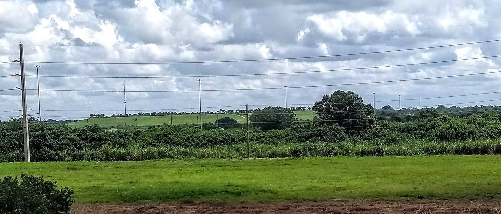
Seen from highway: Owner James Gabbert who plans a Waste Transfer Station
on this six-acre site.  Beyond the treeline is Parcel #2, with the Celery Fields in background

2. It is confirmed that James Gabbert will receive the long-sought permit to build his Waste Transfer Facility, or WTF, on the six-acre parcel he owns at Porter and Palmer (the left rectangle of parcel 2). It's the first property one sees when coming from the West through the Palmer I-75 underpass.

Mr. Gabbert is expected to receive final approval (no public hearing required) within two weeks. For those wondering what can be done  to mitigate this authorized blight, we'll have some suggestions in the coming week. We'd like to hear yours as well.

3. Sarasota Audubon will hol a workshop about saving public lands from development - see the attached flyer. It's an opportunity to learn some important things. It's free at the Audubon Nature Center (at the foot of Mt. Celery) on Feb. 15, 1:30 pm.


As always, thanks for caring about our entire Celery Fields area -- and about honest, transparent, sensible planning.

Tuesday, January 15, 2019

Fire Station workshop set for Jan. 23

Parcel #3 -- the NW quadrant at Apex and Palmer -- has long been considered for the site of a new Fire Station. A neighborhood workshop is set for Wednesday Jan. 23, 6 p.m. to describe the plan and receive community feedback. Brian Lichterman is the agent, and the workshop will meet at Colonial Oaks Park Meeting Room A, 5300 Colonial Oaks Blvd. More detail below.


Friday, January 4, 2019

New Power Lines will not be near Celery Fields

FPL has made its decision on the route of the new transmission lines that will support growth in East Sarasota County, and it's the choice preferred by the communities near the Celery Fields, Sarasota Audubon, and the Fresh Start Initiative -- the route along Clark Road:

FPL Power line route along Clark Rd (click image to enlarge)

Celery Fields advocates and residents had expressed concern at an optional route that would have taken the tall power lines along Palmer Blvd and Apex Rd. near the birding, wildlife and recreation area. Here is the communication from FPL manager Rae Dowling:
After an extensive route selection study by the project team, that included feedback from a diverse Community Advisory Panel, an open house meeting, and meetings with neighborhood groups and community leaders, I’m writing to let you know that Florida Power & Light Company (FPL) has selected its preferred route for the proposed Bobwhite-Howard 138 kV transmission line. On behalf of the entire project team, I want to thank you for your participation in our Community Advisory Panel and for the time you invested providing your perspectives for us to consider in our study.  Having the perspective of our customer’s voice in important to us and we truly value your contribution to this important project. The preferred route, which is included in the attachment to this email, follows along almost the entire 13-mile length of existing FPL transmission and distribution lines, a siting criteria consistently endorsed by our customers. Route surveying work will begin on this project this month.  If you have any questions, please contact myself at the numbers below or Daniel Hronec, P.E., Project Manager at (561) 904-3638 or by email at Daniel.Hronec@FPL.com. Thank you. 

Tuesday, January 1, 2019

Recommended Framework for Quads Plan: Executive Summary

This is the short version of a recommendation that the Planners adopt a broad scope in the Critical Area Planning Process for the public lands at the Celery Fields.
===
Nutshell: Integrate stranded assets into a substantial recreational and visitor opportunity by investing in our public lands at the Celery Fields for the public good.
A careful look at the public “Quads” parcels at the Celery Fields reveals a key area in radical transition. Sarasota County’s Critical Area Plan, or CAP, will study the surroundings for compatibility, consistency, walkability, and potential enhancements. The Board’s commendable decision to authorize this process in fact helps identify a new and unusually diverse “dual destination” for residents and visitors.

One goal of the CAP is to optimize mobility. Plans already on the books call for a highway flyover connecting UTC/Nathan Benderson Park west of I-75 with roads and trails to the East via Lakewood Ranch Boulevard. The Boulevard will run into Fruitville Road at Coburn Rd., which becomes Apex Rd. and runs south to the Quad parcels at Palmer Blvd. Key visitor areas -- UTC/Benderson and the Celery Fields will be linked via trails for bicycles, pedestrians and runners. Imagine the athletic events that could begin at one attraction, “fly over” the highway, and end at the other!

Safe circulation through a large interconnected area without need of the highway will open up a wide variety of things for both residents and visitors to see and do. At UTC/Benderson they’ll find restaurants, shopping, the rowing park and Mote aquarium; down at the Celery Fields, they'll enjoy a tranquil environment for hiking and birding, as well as lions, tigers, horseback riding, kayaking and picnicking in one of the most beautiful spots in Florida.

Clearly our public parcels sit at a key intersection. With some careful thought they can:
  • Protect and enhance the Celery Fields with support facilities (parking, food) to meet future needs
  • Integrate stranded assets like the north Celery Fields waterway, Ackerman Park, Big Cat Habitat with UTC/Benderson Rowing, Mote, and more.
  • Help address road networks, trails, bus loops, visitors’ center and more to optimize experiences for residents, businesses, schools, and visitors.
A modest investment of tourist tax dollars for these enhancements will transform the I-75 corridor into a powerful economic catalyst, revitalizing surrounding neighborhoods and business districts. A bold, creative plan will create a diverse, interconnected inland attraction we can all be proud of.

Invest in our public lands at the Celery Fields for the public good.

Complete version here 

Monday, December 31, 2018

For a happier new year for the Celery Fields

Chuck Behrmann's photos at the Celery Fields speak eloquently to the special nature of Sarasota's unique bird sanctuary. The pristine protection it affords over 226 species of birds was not the result of some government plan.

Wise governmental stewardship would acknowledge Nature's gift and do everything to protect it from harsh or incompatible development. 

Sandhill Crane preening at the Celery Fields wetlands - Chuck Behrmann.
Good stewards would make sure nearby public lands are not used in a way that would impair the quality of the land, air, water, and wildlife. Sensible stewards would give this precious area an adequate buffer zone, sufficient parking, and healthy options for nearby public properties. They would use Critical Area Planning to develop a suitable vision in concert with the community. 


Let's work to make this a truly happy New Year for all.


photos courtesy of the Celery Fields group or from this blog.

Sunday, December 23, 2018

A new plan for the Celery Fields

Nowadays, mammoth condo and apartment communities are popping up all around the animal sanctuary and the nearby Celery Fields, one of the last remaining undeveloped green spaces in Sarasota County. Herald Tribune, 12.22.18.
Celery Fields, Sarasota

To the Board of Sarasota County Commissioners:
A "Critical Area Plan" (CAP) is a technical tool -- an innovation first developed by Sarasota County planning years ago. According to one of the original planners who developed and implemented CAPs over many years, the purpose of establishing a boundary for a CAP project is to insure that all the important changes a proposed development will bring to a specific area are addressed.*
As a tool for gauging compatibility, clearly the CAP boundary is not intended to encompass just the area of the project. That would not make sense.
When the Fruitville Initiative was designed, the boundaries of the CAP benefited from public input, solicited by the County.
On Sept. 12, 2018, the Board of Sarasota County Commissioners decided it was time to revisit the Critical Area Plan (CAP) for the Quad parcels near the Celery Fields in light of the current context and realities. A discussion item on this is scheduled for Jan. 29, 2019 (time to be determined).


This should provide a long overdue opportunity to envision what is possible at the Celery Fields area, considering the mismatch between old plans from 1983 and the new reality of a world-famous birding destination in the area.


Before starting the CAP process, the BCC will first need to approve the boundaries (i.e. aerial extent) and criteria (plan tasks) at a public hearing.
When Restaurant Depot’s giant warehouse proposal came before this board two years ago, their Critical Area Plan was contrived to coincide with the boundaries of its own parcel. That is to say: the impacts of the giant warehouse upon the Celery Fields and other surrounding parcels were explicitly ignored by the very planning tool that's supposed to take those impacts into account.

In advance of setting CAP boundaries and criteria for the Celery Fields, the defined process requires staff to proactively conduct public meeting(s) to solicit public input on the boundaries and criteria, much as was done at this stage of the Fruitville Initiative.

Given the success of the Audubon Nature Center, the expansion of the Big Cat Habitat, and the undeniable need for more parking and complementary facilities for the tens of thousands of birders, recreationalists and eco-tourists who flock to the Celery Fields each year, it is clearly time for the County to re-envision the entire Celery Fields Area to address its current uses, context and future needs for the people of Sarasota County.
The Fresh Start Initiative

*Sarasota News Leader


Saturday, December 8, 2018

Making Things Much Worse Indeed


Making Things Much Worse


BY GENE KUSEKOSKI SRQ DAILY 
SATURDAY PERSPECTIVES EDITION 

SATURDAY DEC 8, 2018 


On the impact of Benderson's Siesta Promenade on its surrounding area,Gene Kusekoski, president of the Siesta Key Association, says this:

==

"The problem with the current Siesta Promenade proposal is EXACTLY about the “What" and the "Where." If this project was being proposed by the most universally beloved organization on earth, it would still be facing strong opposition because it is quite simply the wrong size and scale for that location.

"Adjacent neighbors who used to have landscaped single-story mobile homes across the street would now be looking up at 40- to 85-foot buildings. Their neighborhood streets that are barely wide enough for two cars to pass would be flooded with hundreds of cars going in and out of the development." 

==

Yet: The County (prodded by Bob Waechter and Bo Medred and Jim Gabbert) keeps saying that industry is appropriate at the Celery Fields because it is already there (although it's mostly set back and not on Palmer Blvd.). Why would the county cite existing compatibility with something as a reason for more of same at the Celery Fields, but go along with a radical shock to a settled area that is full of people, not industrial operations?

The 360-acre Celery Fields dwarfs the small old industrial area to its left, set back from Palmer Blvd.

Saturday, December 1, 2018

Public input to the reopened Critical Area Plan at the Celery Fields

We last wrote to the Board requesting that citizens be included when the Board reopens the Critical Area Plan for the Celery Fields:

Yesterday came this reply from Jane Grogg of Planning:
Good afternoon, 
The Board direction was for staff to bring back a scope of work for amendment to the Critical Area Plan by January. If they decide to move forward, staff would perform the analysis and hold associated public workshop(s) before returning to the Board with the draft amendments. The Board would then have the option to authorize the amendment process for hearings at the Planning Commission and Board. Since this is an existing CAP, the boundaries of the CAP is have already been adopted.
Thank you,
Jane

Given the active and intense interest in our communities as to the fate of this area, and given that the county has not begun to provide the necessary support for its continued safe and protected existence as a bird sanctuary, public recreation space, and natural habitat for wildlife, we believe that our communities and the public in general have earned the right to play a real part in basic decision making that will result from reopening the CAP.

One key element of reopening the CAP is in fact the opportunity to take a new look at its boundaries. 

As this goes forward, the CAP can be modified to allow more robust roads, and therefore allow for industry. Or, it can be modified in accord with the values and vision of the community. Which way will our Board and staff go?


Thank you for your commitment to the welfare of our neighborhoods.

Wednesday, October 17, 2018

Email to Staff: Public Input on the CAP process for the Quad parcels

Email October 17, 2018

Dear Matt Osterhoudt and Jane Grogg,

On Sept. 12, 2018, the Board of Sarasota County Commissioners wisely decided that it was time to revisit the Critical Area Plan (CAP) for the Quad parcels near the Celery Fields in light of the current context and realities. 

This provides a long overdue opportunity to envision what is possible, rather than trying to adapt it to outdated planning decisions.

Before starting the CAP process, the BCC will first need to approve the boundaries (i.e. aerial extent) and criteria (plan tasks) at a public hearing. 

In advance of that hearing, it is appropriate for staff to proactively conduct public meeting(s) to solicit public input on the boundaries and criteria, much as was done at this stage of the Fruitville Initiative.

As the future of these public lands is of demonstrable public interest, please advise as to your timing, scope, and process.

Thank you,

Glenna Blomquist, Carlos Correa, Tom Matrullo, Gary Walsh
Executive Council, Fresh Start