Showing posts with label sarasota planning. Show all posts

Monday, July 1, 2019

Conservation Foundation update: Contributions total 7% of deadline goal

Verbatim email from Conservation Foundation of the Gulf Coast:

Dear Friend of Conservation,

As you know, we have been on a fast track to save Graceland, with a goal to raise $650,000 in community donations by June 30th in order to fulfill the terms of our contract and protect this land forever.
Although we raised $46,240 from generous supporters in the community, this represents only 7% of our goal. Therefore, sadly, Conservation Foundation is unable to meet the initial deposit deadline, which terminates our contract to purchase Graceland and conserve it for generations to come.

We are extremely grateful to all who helped spread the word about this campaign. Our deepest appreciation to those who donated to protect this rural area for wildlife and for those who live, work and play in Sarasota and Manatee counties.

If you made a donation, please know that you have the option to allow your gift to go towards other Conservation Foundation projects that save land and unique places in perpetuity. Or, you may request a full refund. Please click on the button below, and let us know your intention.

Conservation Foundation cares deeply about the community's open space needs. And, we support the community's ongoing efforts to protect the Celery Fields and its surrounding lands like the Quad parcels. 

Thank you again for your support and advocacy of our mission to save our region’s beautiful and wild places.

Yours in conservation,
 
Christine P. Johnson
President


Sunday, June 9, 2019

Regarding Critical Area Plan Scope: A Letter to Planning

Note: this originated as an email to the chief planner working on the Critical Area Plan authorized by the Board of Sarasota County Commissioners for the area of the public parcels at Apex and Palmer Blvd, often referred to as the "Quad" because they form the four quadrants at that intersection, adjacent to the Celery Fields on the east. See also here.
The four public lands known as the Quad parcels


Dear Steve Kirk,

I have been collecting some questions from our community that have come up since the May 14 Quads public workshop, and will list a few of them here. 

1. Will you be providing a transcript of your audio recording of workshop, and if so, where may we download it?
On this point, a video of the workshop is posted here - it's complete but for the first minute or so:
2. Thank you for sharing our community proposals on your site - will you continue to post proposals as they come in? I ask in part because I recently saw one from Jono Miller which has yet to be posted to the CAP site.

3. What are the tasks left in your timetable, which I understand could extend to November? 

4. When will your report be published? Will it be simultaneous with handing it to the Board, or in advance?


SCOPE


5. Can you help us understand in some detail the "scope" of your study? Allow me to explain why this matters. 

For our purposes, we believe your process will perform a very valuable service in meeting the objectives listed by the County:

As the county description below states, the purpose of a CAP is manifold:

The CAP approach looks holistically at development and existing communities by coordinating drainage, transportation, water and sewer, environmental systems and the protection of habitats.
  • Purpose and objective of a Critical Area Plan:
  • Provides a bridge between the general characteristics of the Comprehensive Plan and the specific nature of permits.
  • Provides information for evaluating future development proposals in critical areas of concern to ensure consistency with the Comprehensive Plan.
  •  Provides a public process for the planning, development and redevelopment and infill, of critical areas of concern and the adjacent areas. It does this through the consideration of historical resources, the environment, utilities, drainage, community services, transportation and land use.
Our question about "Scope" arises in relation to the specific dataset you use for your plan. If you choose to keep a very tight, narrow focus, you will see things that are near -- e.g. Gabbert's new Waste Transfer Facility and Mr. Waechter's warehouses, and the new fire station -- but limiting your data to this, you'll not capture the true profile and profound changes happening in the area.

    Robert Waechter's warehouses south of parcel #2
We believe that to fulfill the mandate of a CAP as outlined, the process must capture a rich profile of the many social, economic, natural, vehicular, eco-touristic, and environmental changes that have occurred to this area since the FLUM was last updated in 1985. To not take all these manifold changes into account would be to miss the most important empirical data and, quite possibly, the very purpose of doing a CAP.

I'm not a planner, but it seems to me that such data would include several items - some of which I mentioned at the workshop - here's a list, which surely can be added to. By the way, this is in acknowledged in the planning memorandum: “An analysis of the general conditions should be performed for the entire CAP area.”

At a basic level, the CAP process can gather layers of data, such as:

  • The rate of the area’s new housing, with prices over time, with radii showing distances from the Quads parcels;
  • The number of vacancies in the nearby industrial/office parks, and trends of vacancy rates in the various office parks;
  • Trends for rents in the nearby industrial/office parks;
  • The number of school buses and school children that are bused along Palmer Boulevard and Apex Road each school day;
  • Which schools currently run buses on Palmer Blvd., where these buses stop, the impact on traffic, the times they operate;
  • The time it takes cars going from a point on Palmer Blvd. -- say from Raymond Road -- to another point, e.g. Honore Blvd. (Take these traffic timing measurements now, and again after Mr. Gabbert’s Waste Transfer Station is in full operation);
  • Assess the impact of Mr. Gabbert’s operation on real estate values in the surrounding area;
  • Analyze the visual impact of Mr. Gabbert’s operation, smack in the line of sight of the Celery Fields for millions driving on I-75;
  • Obtain trending tourist visitation numbers for Audubon Nature Center and for Big Cat Sanctuary over the last 5 or more years.

Widen the scope further, and significant trending changes come into view:
  • Nearby developments include projects already underway like Worthington and Artistry, as well as others yet to start, such as sectors of the Fruitville Initiative (see, for example, this information about “Southwood Village”);
  • Potential synergies from the planned flyover that will bridge the highway to connect Benderson Rowing Park with Lakewood Ranch’s new Waterside development (5,100 dwelling units along with commercial and recreational uses), with road and trail links to the Celery Fields;
  • Palmer Blvd. should be looked at as a whole in this CAP process - it’s one road, and decisions on land uses will affect its performance east and west of the highway.

And of course the reality of change can't be addressed without including the time frame from 1985 to the pent-up demand of developers who are coming with giant new East County subdivisions, including:
  • More than 30,000 dwelling units planned (some already under construction) at Hi Hat Ranch; Waterside; the Fruitville Initiative; Pat Neal's project formerly known as Lindvest, with even more housing proposals on the way.
  • Detailed projections for needs - all these new residents will seek open space, recreation, community spaces, a “Central Park for Sarasota”;
  • New tourism options - such as a Visitors and History Center.- to connect with new potential synergies coming with the flyover connecting Benderson Rowing Park (and the planned relocation of Mote Marine) to Jensen's Waterside and down via Lakewood Ranch Boulevard to Coburn->Apex->the Quad parcels -> The Celery Fields -> Big Cat and more.
Please note - the above is all coming to you as a large question, regarding the scope and ultimate dataset of your study. It is consistent with our concern that the truly new, and unique natural and social profile of the area be fully taken into account, and considered within the context of current trends and future projections.

So our final question (for now) is this: Please give us some detailed sense of the tasks before you, and the extent to which they are designed to capture the data, trends, population projections etc. which we feel are basic to this vital decision about this vitally important area.

Thanks in advance,

Tom Matrullo with Glenna Blomquist, Gary Walsh, et al


Tuesday, May 14, 2019

Media Updates: Fresh Start and the Celery Fields, 2017-19

ABC7 WWSB: Sarasota County asking for public opinion on future of land . . .

SRQExperience Overview of Celery Fields and Quads - thanks to Len Besterman.

Herald Tribune May 13, 2019: Matrullo: A big idea near the Celery Fields

Sarasota News Leader: May 3, 2019: Permitting Process continues for Waste Transfer Facility near Celery Fields

Herald Tribune March 9, 2019: Waste transfer facility to be built near Celery Fields in Sarasota County

Sarasota News Leader, Oct. 12, 2018: Commission calls for analysis before rezoning Quad parcel #3

Herald Tribune Oct. 10, 2018: Sarasota County still contemplating uses for land near Celery Fields

Sarasota News Leader Fresh Start Initiative leaders plead for County Commission to undertake commonsense approach to future planning around Celery Fields, making use of connectivity and recreational opportunities  (For non subscribers: Link courtesy of publisher)

Herald Tribune  Matrullo: Protect sites near Celery Fields

Sarasota News Leader The goal is to maintain a welcoming place

WWSB ABC 7 MySuncoast: Community group leaves disappointed by Commissioners response to Celery Fields proposal  (Taylor Torregano reporting, 9.12.18

Herald Tribune: Plans for land around Sarasota County’s famed Celery Fields still up in the air

Local Group Turns In Celery Fields Proposals - (video) Taylor Torregano reporting, 7.13.18


WWSB ABC 7 Fresh Start Initiative Submits Proposals for Celery Fields (print)

WUSF Tampa: A Community Group Presents How Public Wants To Use Land At Celery Fields In Sarasota 7.12.18

"Cultivating Happy Accidents" - Urban Planner Daniel Herriges discusses the Celery Fields public lands and the Legacy Trail controversy in addressing land use practices in Sarasota County, in Strong Towns.
The root problem is that Sarasota County will have budget shortfalls for the foreseeable future because its development pattern is unproductive.


Herald Tribune
Sarasota County extends deadline for Celery Fields development plan April 25, 2018


Sarasota News Leader


The Observer

Commission eager to find profitable use for Celery Fields properties April 25, 2018

Group to give ideas for land by Celery Fields April 18, 2018

Residents to give commission ideas for future of county-owned land Dec. 7, 2017

Commission votes not to allow recycling facility outside of Celery Fields, Aug. 23, 2017


Herald Tribune
Celery Fields advocates propose uses for surrounding land

FPL weighs option on transmission line route east of Interstate 75

Lyons: Why so much county welcome for an unwanted neighbor?


WMNF Tampa: Sarasota environmentalists oppose waste facility near Celery Fields

WGCU (NPR Fort Myers-Naples-Sarasota) + WUSF (NPR Tampa)
Sarasota Planning Board Rejects Plant at Celery Fields, June 2, 2017
Celery Fields Birding Enthusiasts Hope Serenity Remains, June 14, 2017
National Audubon Society President Focuses on Florida


2.25.17 Bradenton Times: Sarasota Stalks Celery Fields for Recycling Plant

WWSB TV - ABC7
***Alan Cohen interviews Cathy Antunes, Audubon's Rob Wright, and former Sarasota Commissioner Jon Thaxton about the influence of money upon County Officials:***


WTSP 10 Tampa

WSLR Sarasota


WSLR Sarasota

Peace & Justice Weds Aug 16, 2017 – 9 a.m. – Sarasota Sustainability and Celery Fields


CeleryFields.org

Celery Fields in the News - 16 news stories about the Celery Fields


WSRQ - The Detail: Cathy Antunes Show
Jan 20, 2017 - Tom Matrullo
Feb. 10, 2017 - Adrien Lucas & Tom Matrullo
Feb. 24, 2017 - Rob Wright
March 3, 2017 - Wade Matthews
April 7, 2017 - Adrien Lucas & Tom Matrullo
May 26, 2017 - Glenna Blomquist, Brian Lichterman, Jono Miller, Tom Matrullo
June 9, 2017 - Carlos Correa & Luigi Verace
Aug. 18, 2017 - Adrien Lucas
Aug. 25, 2017 - Adrien Lucas & Tom Matrullo
Dec. 1, 2017 - Elizabeth Gomez-Mayo, Dan Kriwitzky & Tom Matrullo
April 20, 2018 - Carlos Correa & Gary Walsh 

Control Growth Now News

CONA Sarasota Meetings

Herald Tribune Letters to the Editor

County should postpone sale of lands next to Celery Fields

Debris Plant at Celery Fields - Jono Miller

NEXT . . .


Thursday, May 9, 2019

Leveraging a triptych of public lands for all to benefit

Florida’s ideal outdoor recreation system will be a diverse, connected, accessible and balanced system of resources, facilities and programs that provides the state’s residents and visitors with a wide range of local recreation opportunities. Statewide Comprehensive Outdoor Recreation Plan
A careful look at the public “Quad” parcels at the Celery Fields reveals a key area in radical transition. Sarasota County’s Critical Area Plan is now studying the parcels and surroundings for compatibilities and potential enhancements.

The Board’s commendable decision to do this study plays into a stunning new opportunity for residents and visitors. We must seize it now, because East County is about to change dramatically. 

In a few years, a highway flyover will connect UTC/Benderson west of I-75 with roads and trails to the East and South.

Planned Benderson/Waterside Flyover
From Benderson, Lakewood Ranch Boulevard will run east through SMR's Waterside, continuing south through the Quad parcels to the Celery Fields. This will form a "triptych" of three key areas, all linked without need of the highway.

Safe circulation through this large interconnected area will open new possibilities for bicyclists, pedestrians and runners. Marathons, triathlons, and cycling events can begin at Nathan Benderson Park, “fly over” the highway, and circulate on public trails through Waterside to Mt. Celery. Such iconic visibility will bring new visitors to the entire area.

At UTC/Benderson visitors will enjoy restaurants, shopping, the rowing park and eventually Mote Aquarium; in Waterside they’ll explore trails before reaching the tranquil environment of the Celery Fields for hiking, birding, kayaking and picnicking (as well as the lions, tigers of Big Cat Habitat) in one of the most beautiful spots in Sarasota.

Everyone going to Audubon or Big Cat at the Celery Fields has to pass through the Quads parcels on the way. These lands sit at a key intersection, where they can strategically serve to:
  • Buffer the Celery Fields with gardens and an urban forest on Parcel #1;
  • Provide parking, food, a bus loop and visitors center on parcels #2 and #3 to meet future needs; and,
  • Optimize the experience for residents, businesses, schools, and visitors. Tree canopied sidewalks and trails will integrate stranded assets like the Celery Fields' north waterway and Ackerman Park with Audubon's birdwalks and Big Cat Habitat.
Public land stewardship should leverage our properties to realize broad value and meaningful public benefit. The result of this new framework will be a powerful economic catalyst, revitalizing surrounding neighborhoods and business districts.

A modest investment of tourist tax dollars will optimize the Quads and the Celery Fields area to safely handle future visitors. So much is here to offer. Let’s create a superb inland environment -- an ecological and recreational Triptych we can all be proud of.


Note: The above is a summary. Read the full proposition at this link: "Diverse, connected, accessible and balanced:" a Community Proposition for the Quad Parcels

- Submitted to the Critical Area Plan Workshop May 14, 2019

-- Tom Matrullo

Wednesday, April 25, 2018

A tale of two updates

The Fresh Start Initiative presented to the Board of Sarasota County Commissioners community-based proposals and for public lands at the Celery Fields as well as a broader vision for the Celery Fields area that came out of five months of discussions, panels, interviews, and a round table process (all documented on this blog).

Below a slide shows possible enhancements to the area, including a footbridge linking the public parcel #1 with the Celery Fields wetlands. Also a tourist center and a parking area, all from the April 25 power point presentation to the Board.


Also on April 25, 2018, James Gabbert resubmitted his proposal for a waste transfer station on 6 acres adjacent to public parcel #2, at Porter Rd. and Palmer Blvd.

Waste transfer station stock image

Gabbert's proposed demolition waste facility for the whole of parcel #2 last year triggered an uproar among Sarasota residents and visitors who opposed placing a dump on public land near the Celery Fields. (Timeline)


Fresh Start thanks its advisory panel, HOA presidents and signatories, delegates, and all who helped develop and refine community-based proposals as well as a larger, unifying vision for the Celery Fields area.


Wednesday, April 18, 2018

Fresh Start to bring community vision to Commissioners April 25


Feasibility | Economic Viability | Compatibility with the Area | Utility to Neighbors

MEDIA ADVISORY

April 18, 2018

What: Fresh Start Initiative Update
When: 9 a.m. Wednesday April 25
Where: Sarasota County Commission, 1660 Ringling Blvd.

Fresh Start to Present Proposals for Public Lands near Celery Fields


The Fresh Start Initiative will present the first-round results of its civic experiment in community-based visioning for public lands to the Board of Sarasota County Commissioners on Wednesday, April 25.

The community Initiative began November 28, 2017, after the Board agreed to hold off on surplus-land decisions for two public parcels near the Celery Fields for six months while the citizen group consulted the community’s wishes for the parcels. Fresh Start cites the support of 50 HOAs surrounding the Celery Fields for the effort.

The results offer a sense of the community’s vision that could transform the two parcels, which total 23 acres, by developing them in ways that would both enhance the natural treasure already there and serve the people of the community, according to members of the group’s Executive Council.
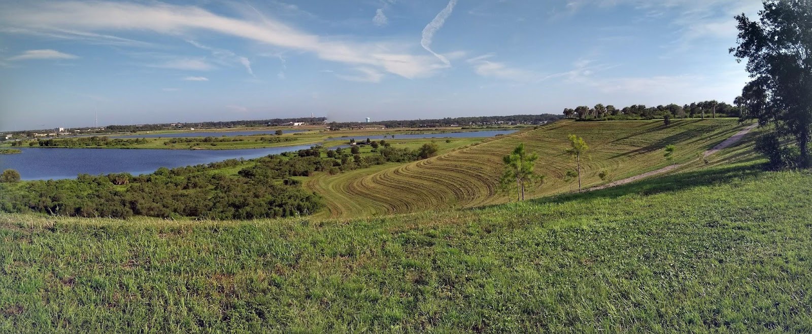
The Quad Parcel
The parcels are at the intersection of Apex Road and Palmer Boulevard. Parcel #1 on the southeastern corner is 12.7 acres and abuts the western edge of the Celery Fields wetlands. Two bird walks there draw tourists from across the country eager to see some of the rarer of more than 225 species known to visit there. Parcel #2 on the southwestern corner has 10.7 acres. The parcels have sat vacant for 20 years.

Fresh Start’s process required time to organize and implement.

"Over the past five months, we have designed, organized and implemented a three-step process,” said Fresh Start council member Marguerite Malone. “We first elicited interest, ideas, and then proposals from our communities. Secondly, we reviewed those proposals through a strong team of local experts in planning, architecture, environment and neighborhood organization. Thirdly, we established delegates from our community who attended a roundtable meeting to discuss, listen, modify, and then vote for the best proposals."

The proposals were vetted both by the community and the Advisory Panel for their congruence with four leading criteria: Feasibility, Economic Viability, Compatibility with the Area, and Utility to Neighbors. Utilizing a weighted vote approach, the roundtable participants selected four proposals -- two for each parcel.

The proposals combine a variety of public uses with private opportunities to offer goods or services on land leased from the county, said Fresh Start member and Meadow Walk president Gary Walsh. Instead of selling the lands outright to private developers, they would remain in public hands, but provide annual revenue to the County via leases, tourist taxes, and employment. Over time that revenue could exceed what a one-time sale would bring in, he added.

The group is scheduled to present details of the four proposals to the County shortly after 9 a.m., April 25.

“In some cases the final ideas combine two or more original proposals,” said Glenna Blomquist of Fresh Start, adding, “There was a creative ferment -- ideas evolved along the way.”

Fresh Start grew out of a community uproar over a developer's proposal last year to convert one of the parcels into an open-air demolition waste processing facility. More than 300 residents concerned about traffic, health, noise, environmental harm, property values and more turned out at the County Commission's August 23 public hearing on the petition, which lasted seven hours before the Commissioners voted the proposal down.

The waste plant was a wake-up call, the group says. While the waste proposal failed, nothing prevents another developer from seeking to convert the same public parcel to heavy industrial use.

“The Board didn’t use the opportunity to direct staff to review the underlying land use provisions for the area, which were put in place nearly 40 years ago -- before many of the residential communities and businesses -- before even the Celery Fields area itself -- existed,” said Fresh Start council member Carlos Correa, president of The Enclave, a residential community on Palmer Boulevard East.

That concern prompted the formation of Fresh Start, which offered to research the area, gather community participation and input, and to come back with some conceptual plans within six months of the November 28, 2017 agreement with the Board.

“The Initiative here was to facilitate a potential synergy of community vision and county supervision,” said Tom Matrullo of Fresh Start. “We are not backing any specific plan, nor are we associated with any organization behind any proposal. We facilitated a community-based method to produce and gain consensus on coordinated, viable plans, creating the opportunity for a positive collaboration between our elected officials and our residents, who were deeply divided over the County’s handling of the Waste Plant proposal last year.”

In addition to proposals for the two parcels, ideas came up along the way for enhancements to the common areas -- a roundabout, a bus loop, a footbridge, and more. The group says such features would unify the area and hopes the County will give them consideration.

The group will present the four proposals selected at the Roundtable meeting to the Commissioners and invite them to take the next step: To authorize staff to work with community representatives on refining them.

“The enthusiasm and creativity of our citizens working on this has been extraordinary,” said Fresh Start’s Blomquist. “A balanced collaborate effort of community and County can transform these vacant public lands into a win/win: a community catalyst that interrelates commerce, history, nature, neighborhood walkability, recreation and tourism.”

Fresh Start has been given 30 minutes for presentation and discussion beginning shortly after 9 a.m. on Wednesday, April 25. The public is welcome to attend the meeting, to be held in the Commission Chamber of the County Administration Building at 1660 Ringling Boulevard. Supporters of Fresh Start plan to wear green shirts or tops.